Here are maps covering the period of Richard Howell’s life and the American Revolution. Also included are maps from the United Kingdom and specifically Wales.
Maps of Early Family Locations#
| Map | Caption |
|---|
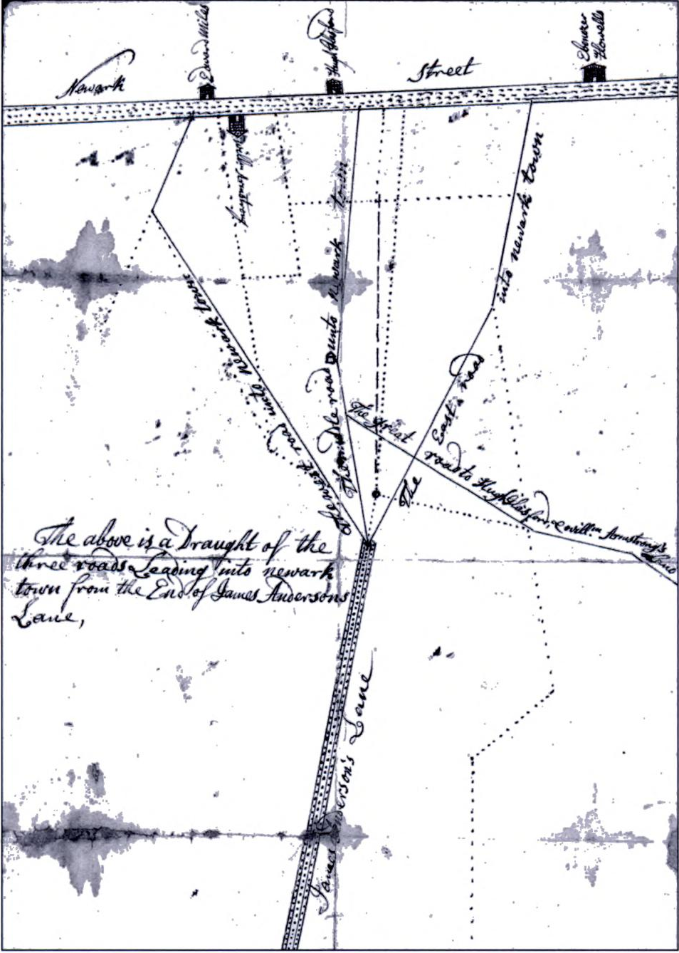 | Newark, Delaware — 1736 — Map of Newark, Delaware at the time Ebenezer Howell’s family lived there before removing to New Jersey in 1769. |
Colonial Period#
| Map | Caption |
|---|
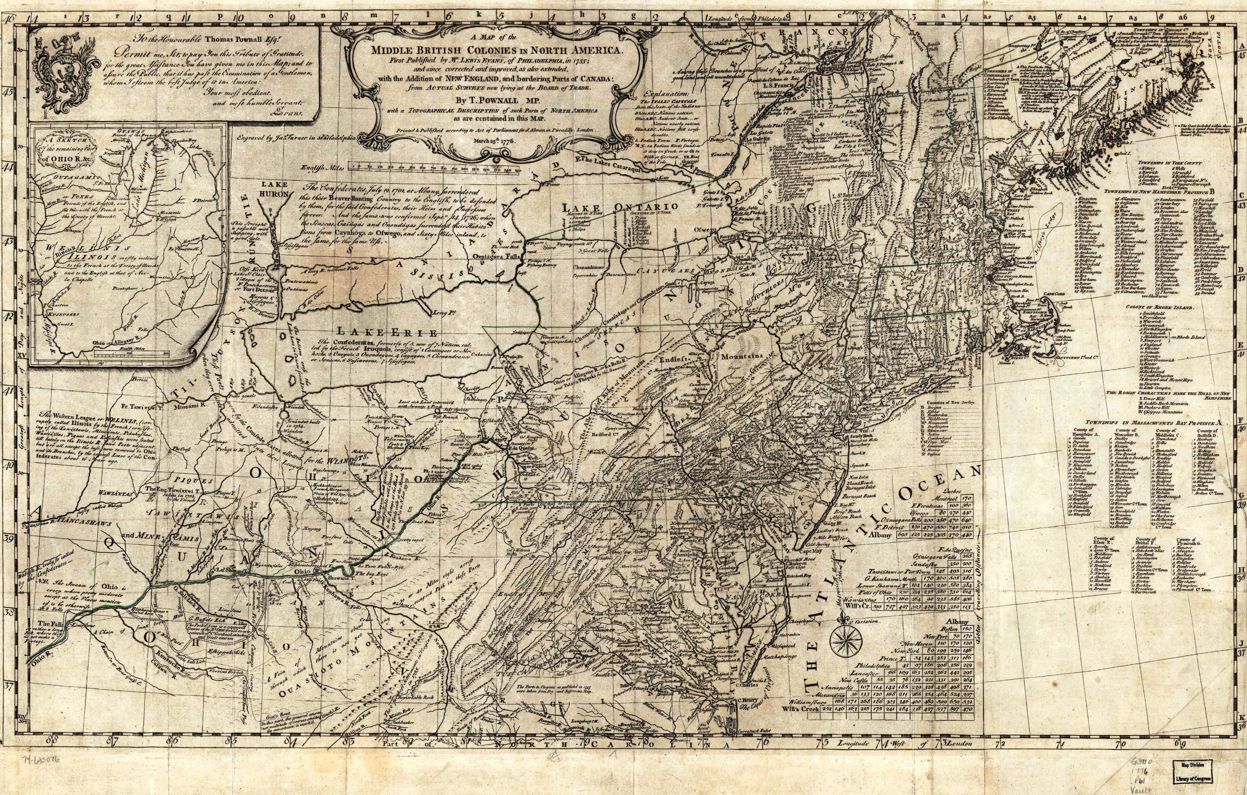
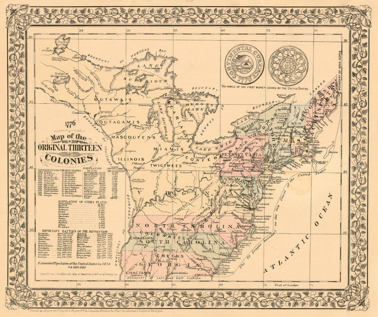 | American Colonies — Map of the original American colonies during the colonial period. |
Revolutionary War Period#
| Map | Caption |
|---|
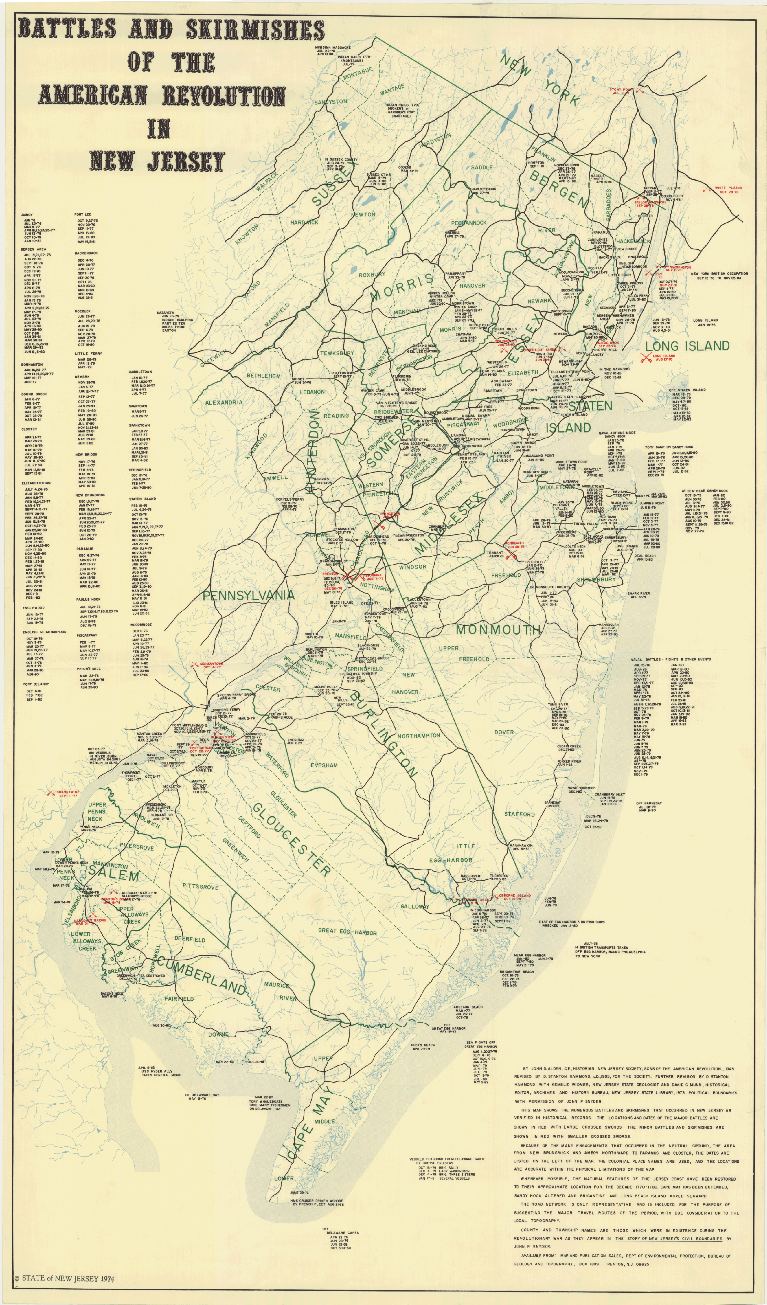 | New Jersey Revolutionary War Battles (1974 map) — Map showing the locations of Revolutionary War battles in New Jersey. Richard Howell participated in several of these engagements. |
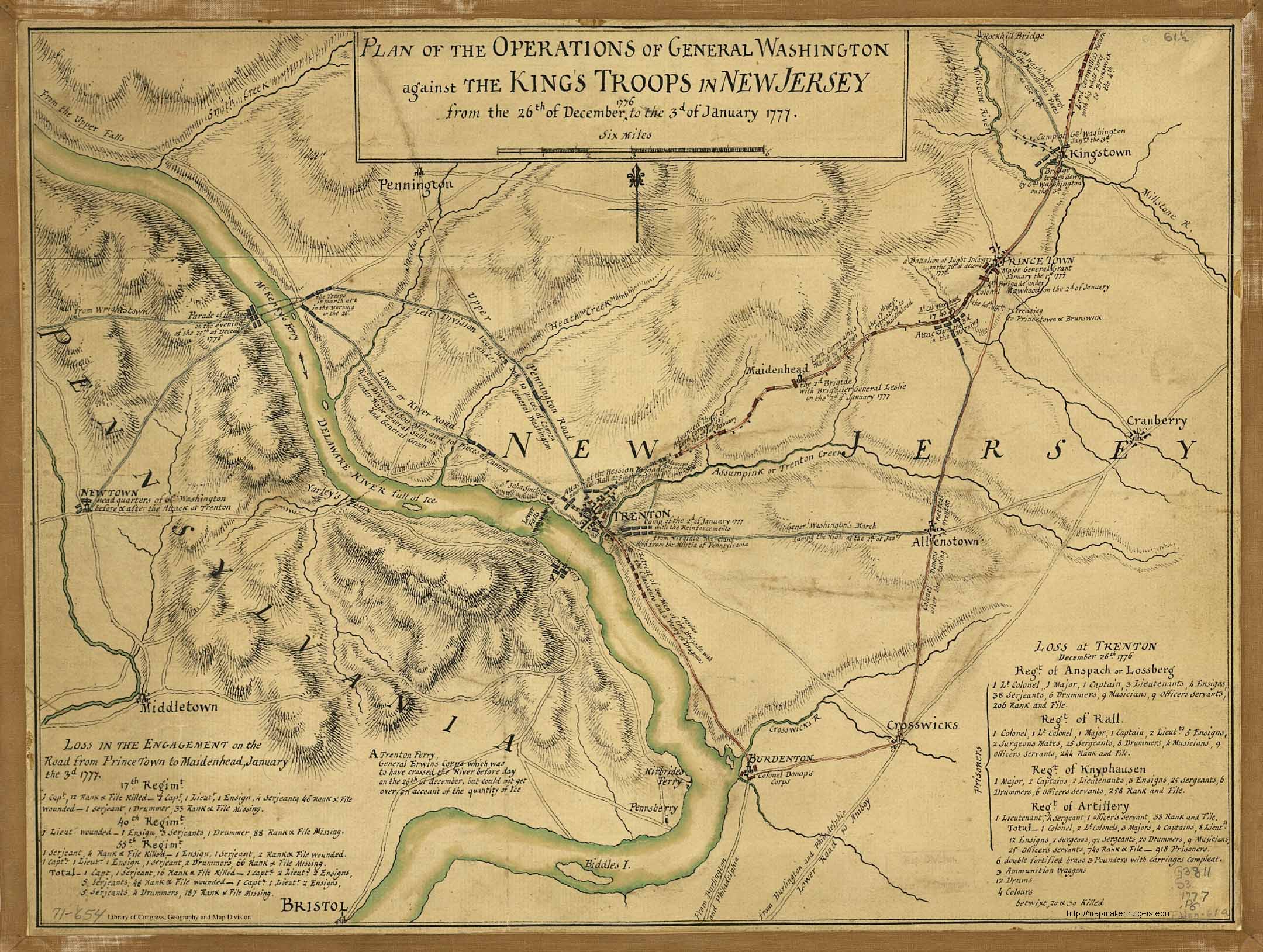 | Plan Map for the Attack on Trenton, NJ |
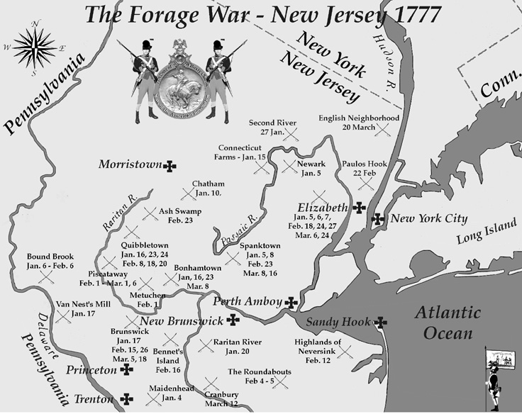 | The Forage War, 1777 — The Forage War was a series of skirmishes in New Jersey in early 1777. |
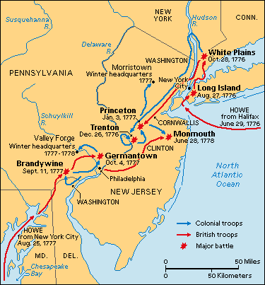
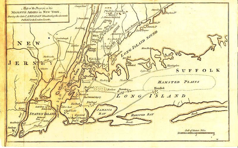 | New Jersey and Long Island — Map of New Jersey and Long Island during the Revolutionary War. |
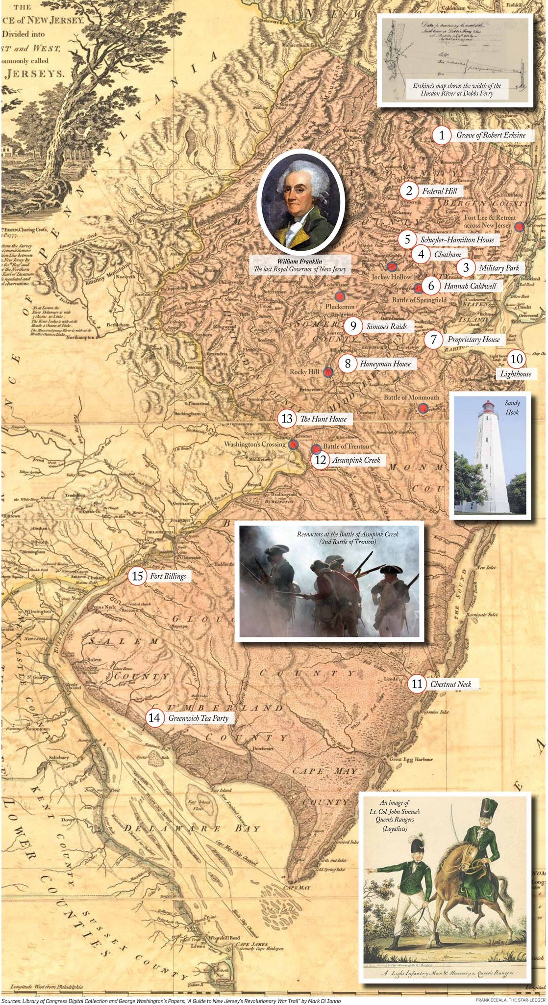 | Revolution in New Jersey — Map of Revolutionary War sites in New Jersey. |
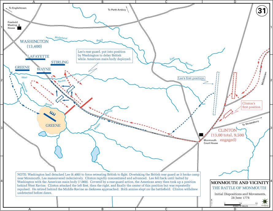 | Battle of Monmouth (USMA) — Tactical map of the Battle of Monmouth, June 28, 1778. Richard Howell fought at Monmouth; his twin brother Dr. Lewis Howell died of illness seven days after this battle. |
 | Monmouth Map — Vintage map of Monmouth County, New Jersey. |
 | 1777 Battle of Germantown — Montresor — Map by engineer John Montresor of the Battle of Germantown, October 4, 1777. |
 | 1777–1778 Valley Forge Encampment — Map of the Valley Forge winter encampment. Dr. Lewis Howell purchased blankets with his own money for his regiment during this encampment. |
 | Battle of Brandywine |
 | Path towards American Independence |
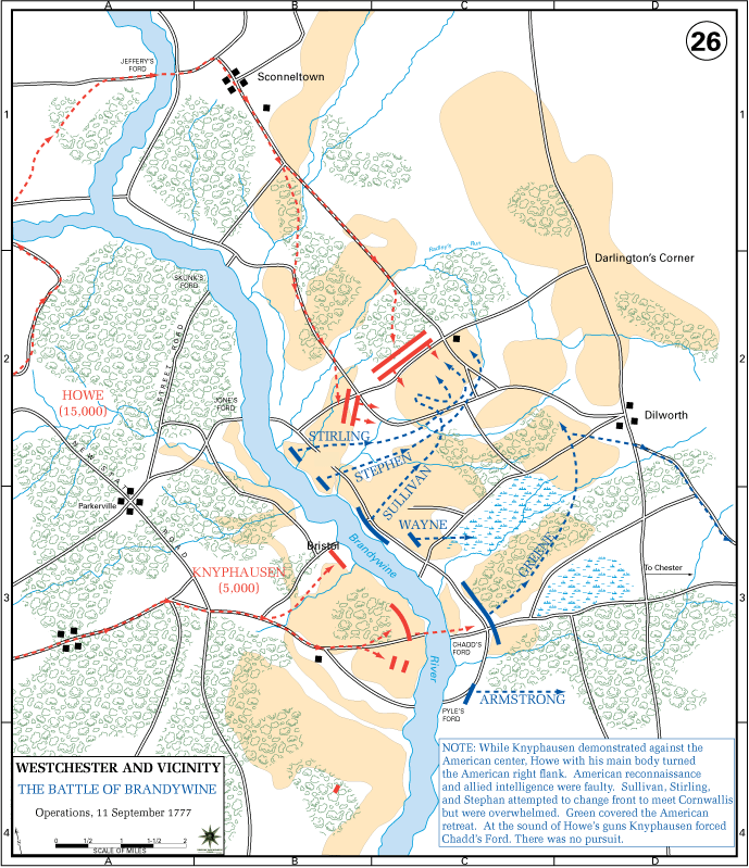 | Battle of Brandywine (USMA) |
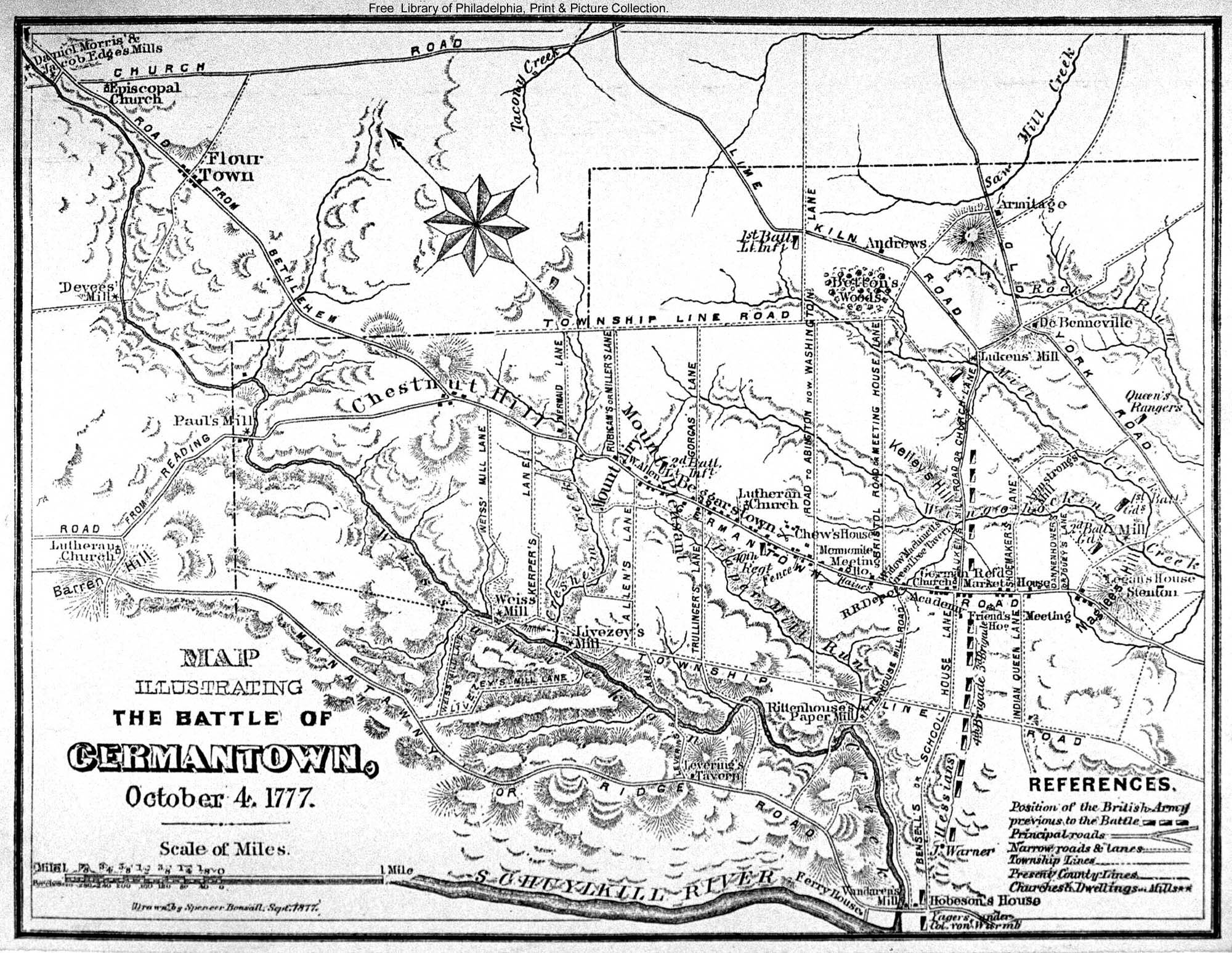 | Battle of Germantown |
 | British War Map, 1776 |
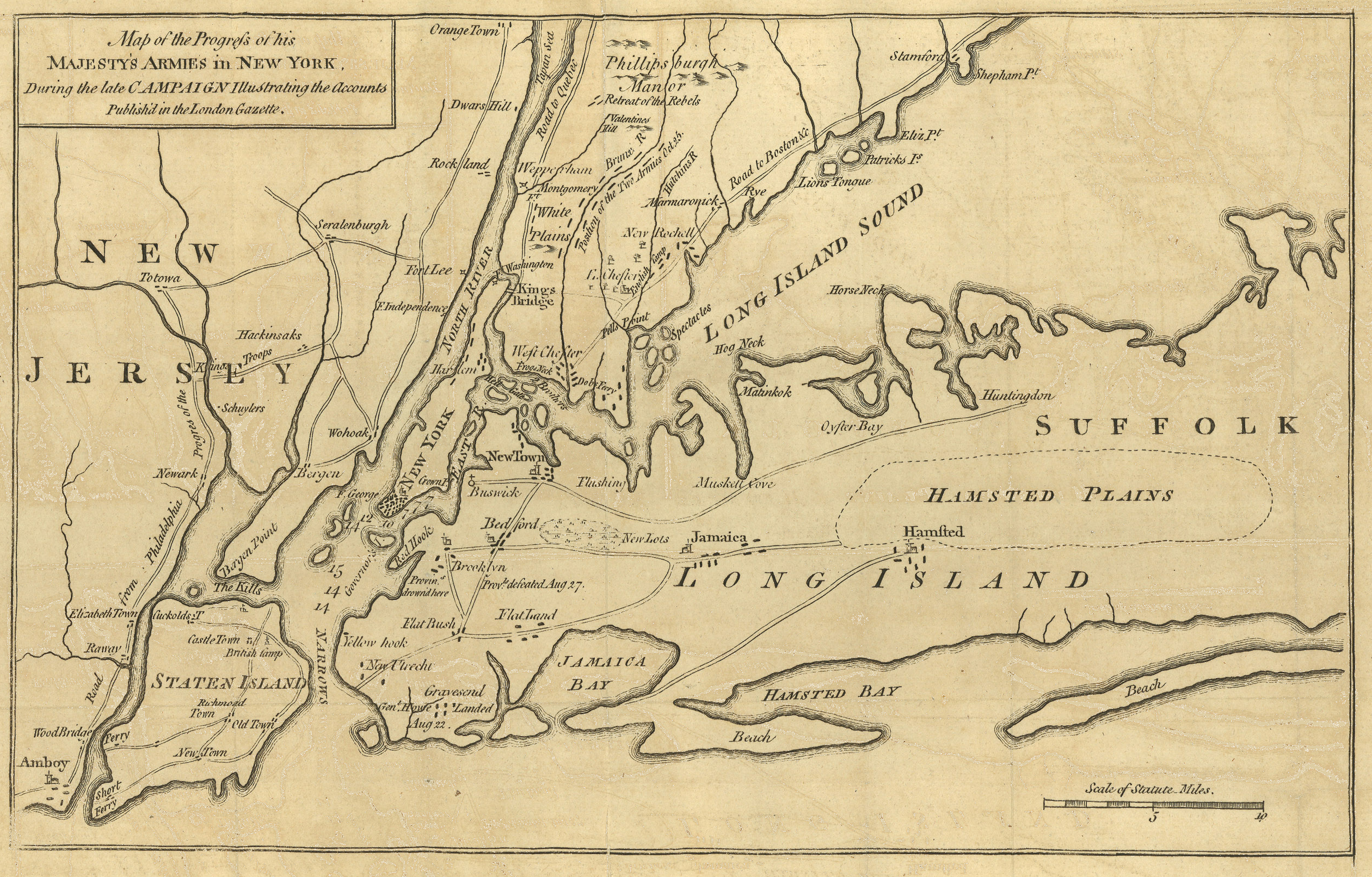 | His Majesty’s Forces in New York, 1776 |
Post Revolutionary War#
Maps for this period have not yet been added.