Here are maps covering the period of Richard Howell’s life and the American Revolution. Also included are maps from the United Kingdom and specifically Wales.1
Maps of Early Family Locations#
| Map | Caption |
|---|---|
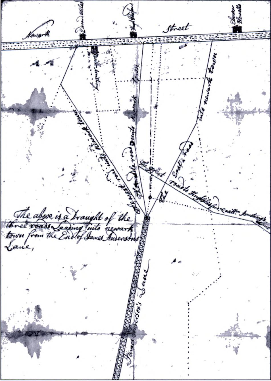 | Newark, Delaware, 1736, Map of Newark, Delaware at the time Ebenezer Howell’s family lived there before removing to New Jersey in 1769.2 |
Colonial Period#
| Map | Caption |
|---|---|
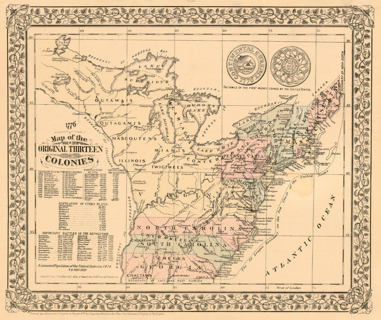 | American Colonies, Map of the original American colonies during the colonial period. |
Revolutionary War Period#
| Map | Caption |
|---|---|
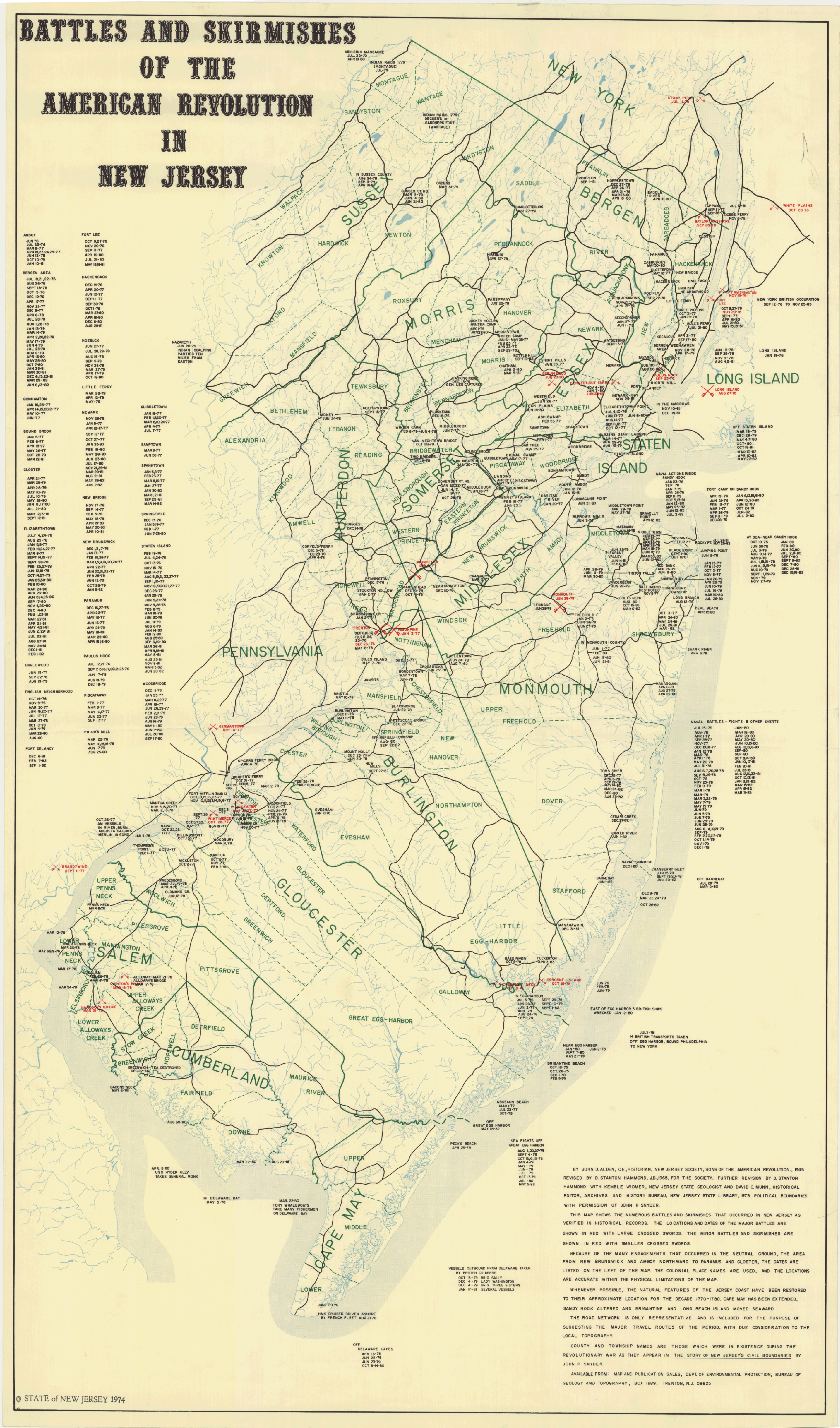 | New Jersey Revolutionary War Battles (1974 map), Map showing the locations of Revolutionary War battles in New Jersey. Richard Howell participated in several of these engagements. |
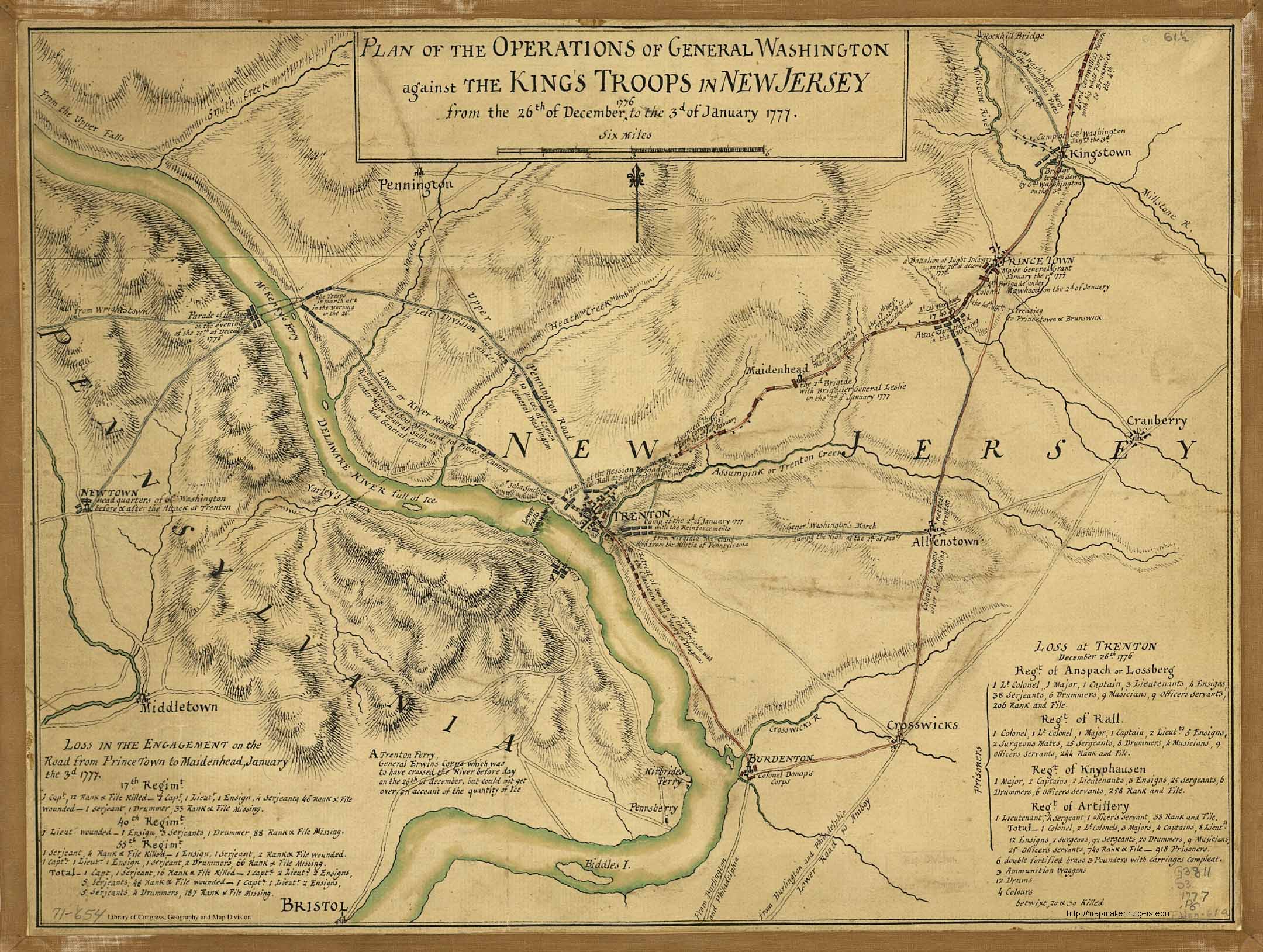 | Plan Map for the Attack on Trenton, NJ |
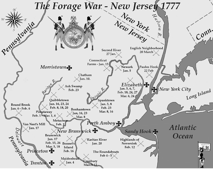 | The Forage War, 1777, The Forage War was a series of skirmishes in New Jersey in early 1777. |
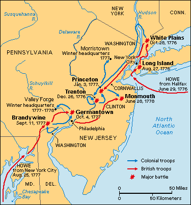
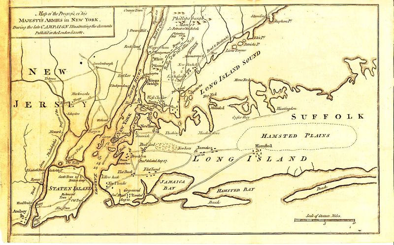 | New Jersey and Long Island, Map of New Jersey and Long Island during the Revolutionary War. |
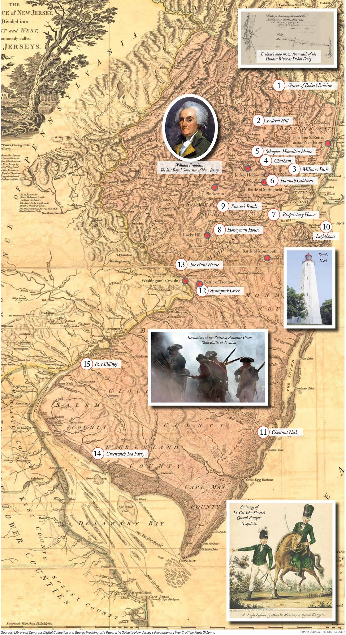 | Revolution in New Jersey, Map of Revolutionary War sites in New Jersey. |
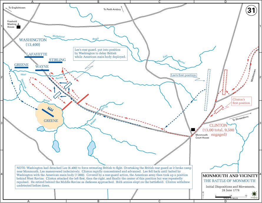 | Battle of Monmouth (USMA), Tactical map of the Battle of Monmouth, June 28, 1778.3 Richard Howell fought at Monmouth; his twin brother Dr. Lewis Howell fell ill during the campaign and died shortly after.4 |
 | Monmouth Map, Vintage map of Monmouth County, New Jersey. |
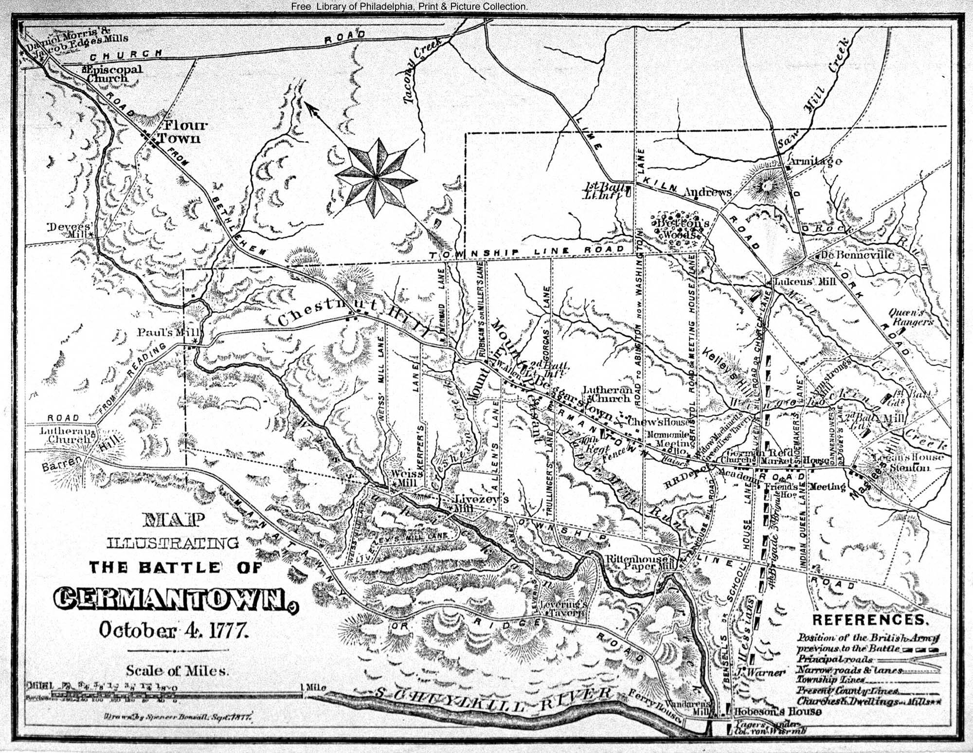
 | 1777 Battle of Germantown, Montresor, Map by British Royal Engineer John Montresor of the Battle of Germantown, October 4, 1777.5 |
 | 1777–1778 Valley Forge Encampment, Map of the Valley Forge winter encampment, where the 2nd New Jersey Regiment wintered with Washington’s main army.6 |
 | Battle of Brandywine |
 | Path towards American Independence |
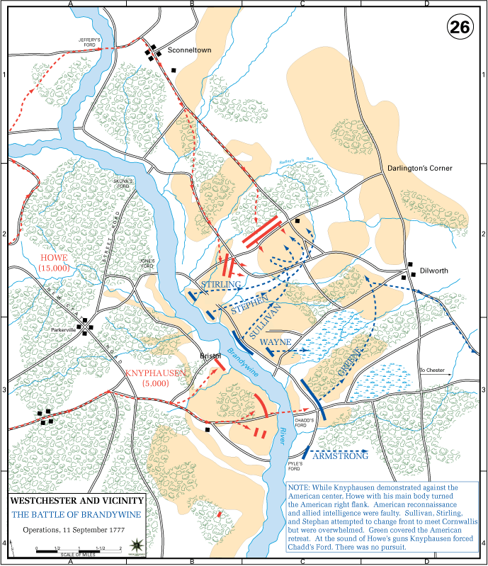 | Battle of Brandywine (USMA) |
 | Battle of Germantown |
 | British War Map, 1776 |
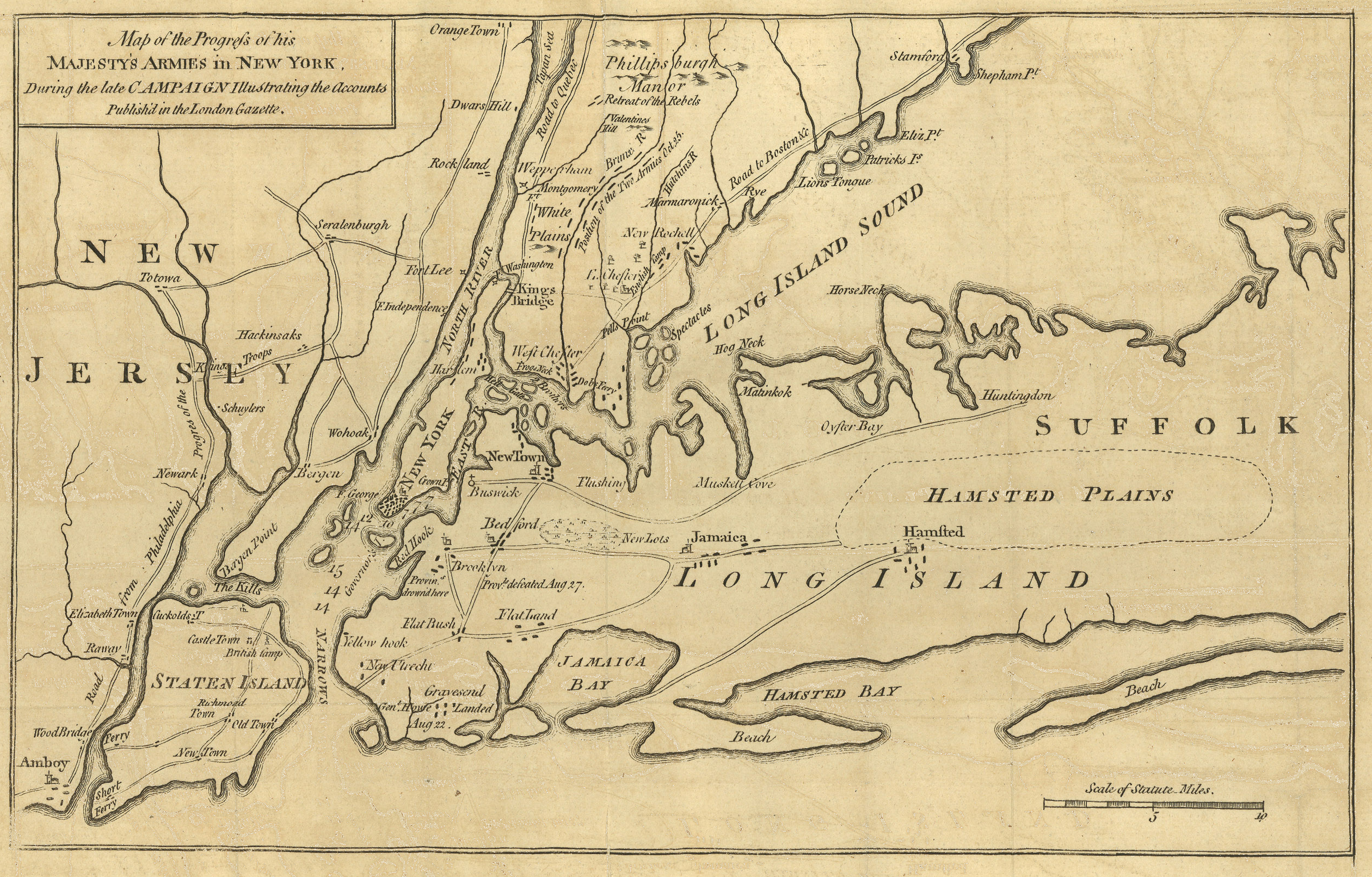 | His Majesty’s Forces in New York, 1776 |
Post Revolutionary War#
Maps for this period have not yet been added.
United Kingdom#
| Map | Caption |
|---|---|
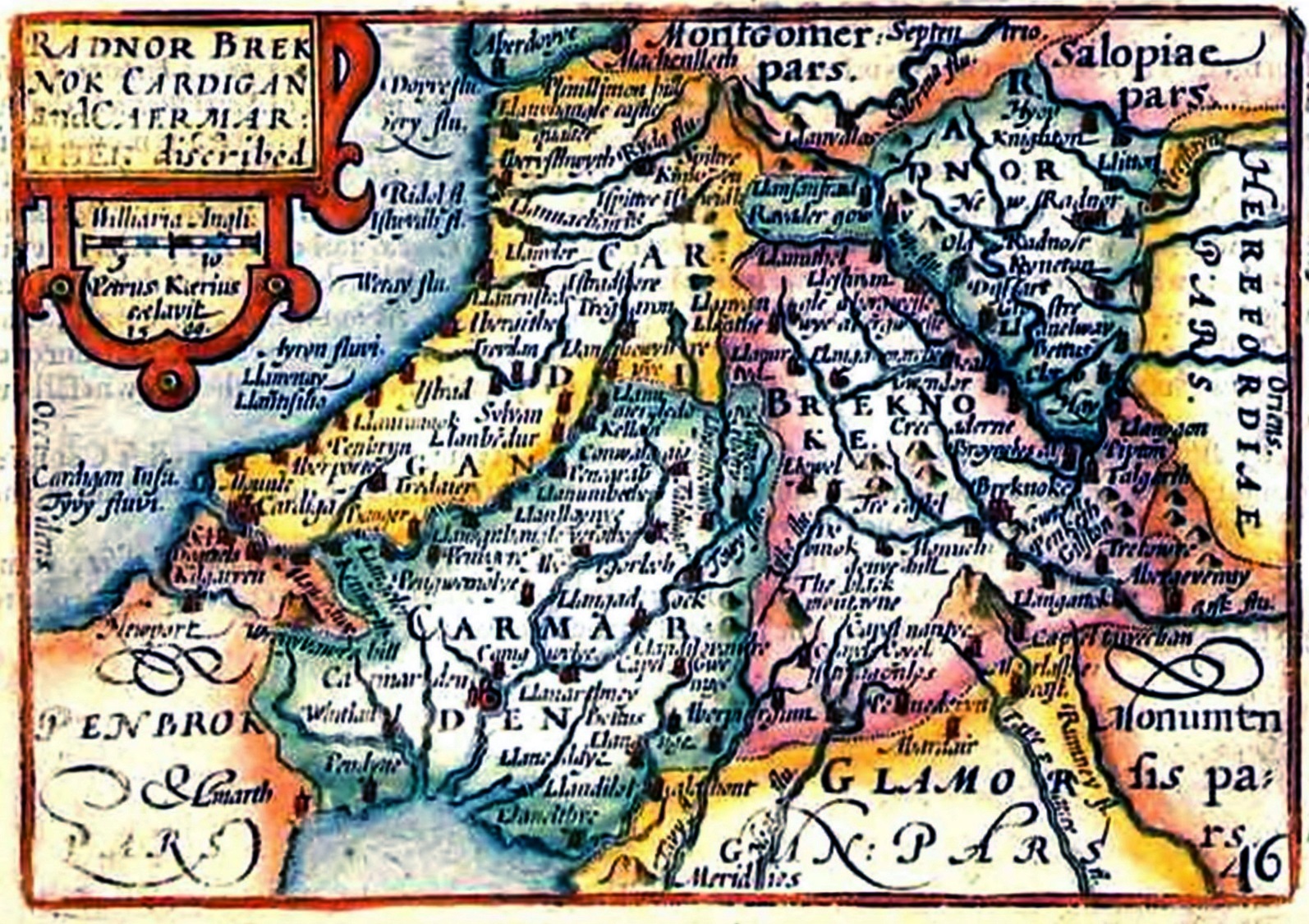 | Radnor (in Wales), 1627, Map of Radnorshire, Wales. The Howell family traces its origins to Wales.7 See the Howell Family History for the Welsh genealogy. |
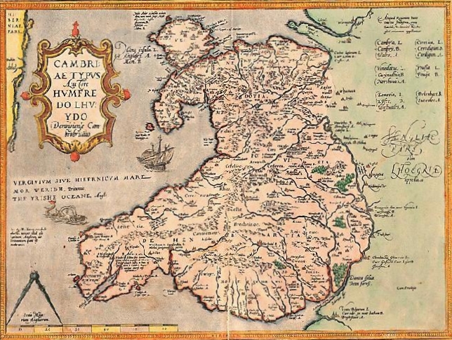 | Earliest Known Map of Wales |
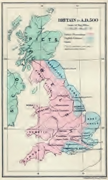 | Britain, AD 500 |
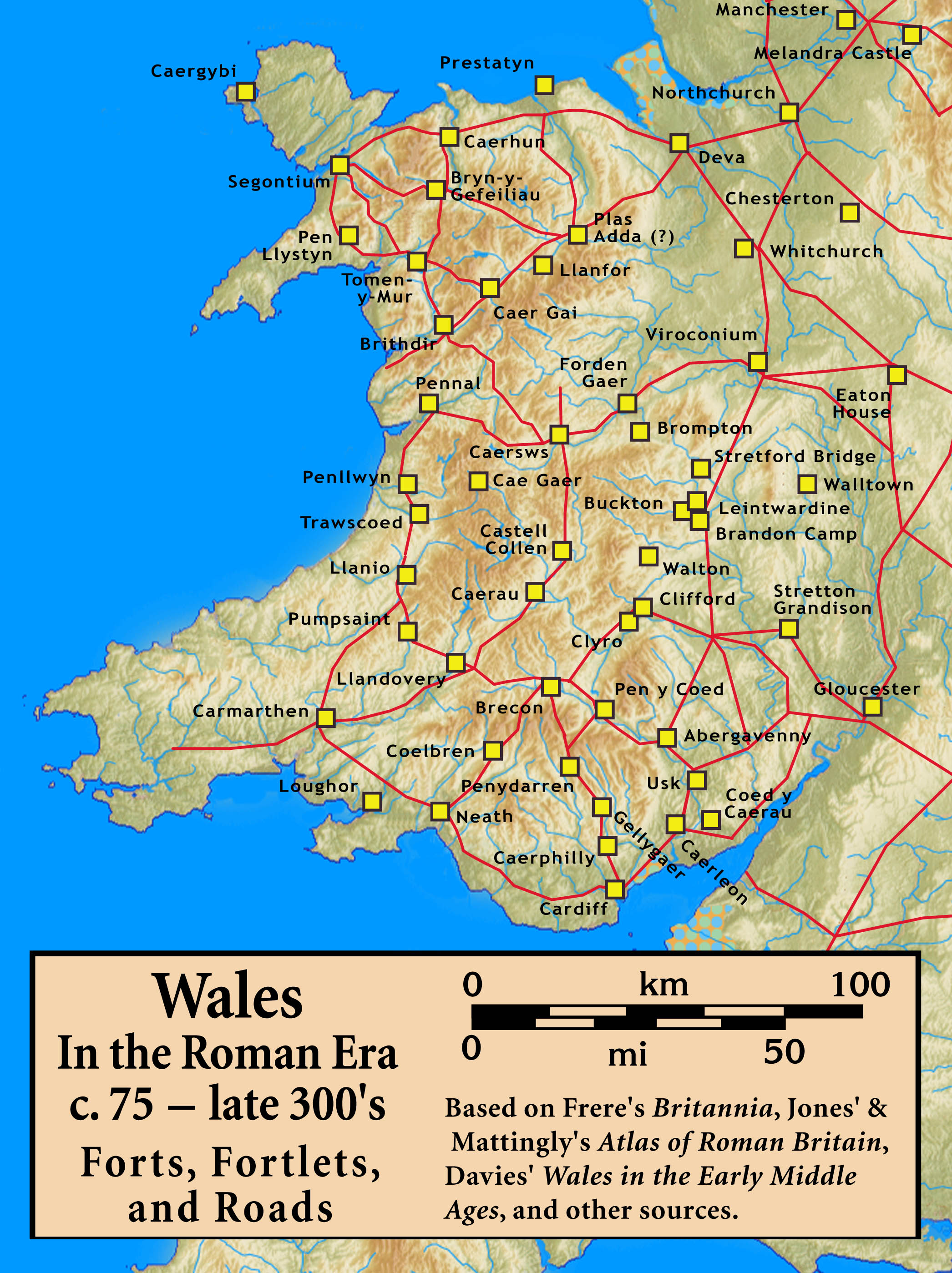 | Roman Era Wales, Forts, Fortlets, Roads, c. 75 – late 300s |
For Richard Howell’s military service and the battles referenced in these maps, see the Biography and Revolutionary War Timeline. ↩︎
Josiah Granville Leach, Genealogical and Biographical Memorials of the Reading, Howell, Yerkes, Watts, Latham, and Elkins Families (Philadelphia: Lippincott, 1898), p. 139, https://archive.org/details/genealogicaland00leacgoog. Ebenezer Howell moved the family from Newark, Delaware, to Cumberland County, New Jersey, in 1769. ↩︎
National Park Service, Monmouth Battlefield State Park. The Battle of Monmouth was fought June 28, 1778. ↩︎
“To George Washington from Major Richard Howell, 7 April 1779,” Founders Online, National Archives, https://founders.archives.gov/documents/Washington/03-19-02-0717. Lewis Howell resigned his commission July 5, 1778, and died shortly thereafter. ↩︎
John Montresor (1736–1799) was a British Royal Engineer who produced detailed battlefield maps during the American Revolution. His maps are held by various archives and are considered significant primary cartographic sources. ↩︎
Valley Forge Muster Roll Project, 2nd New Jersey Regiment; National Park Service, Valley Forge National Historical Park. ↩︎
Leach (1898), pp. 129–132. The Howell name traces to Hywel Dda (c. 880–950), king of Deheubarth, who came to rule most of Wales. ↩︎